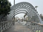
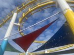
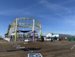
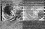
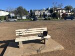
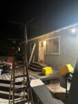
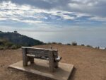
2025-06-15 10:46:46
Steve Engelmann
Santa Monica Pier, United States
United States
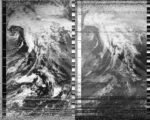
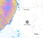
NOAA-19
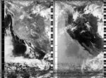
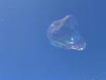
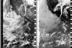
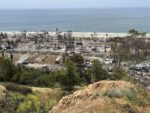
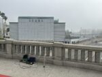
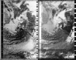
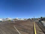
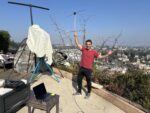
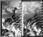
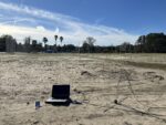
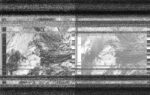
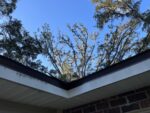
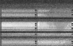
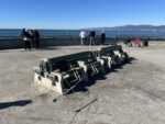
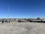
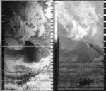
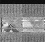
I went to the Santa Monica Pier to capture NOAA 19 as it flew over. The pier was a little busier than recently. The weather was great. School is out. It is Sunday and Father's Day. I was approached by a group of what I guess were Chinese tourists. They asked if someone is doing this in China. Almost a soon as they finished the question, they added, probably a bad idea. Another man was entertaining people with his bubble making abilities. The problem was his audience was up on the pier. He was down below on the sand. His tip bucket was in the sand next to him. Just as I was packing up a small airplane flew by pulling a sign that read, "TRUMP YOUR BDAY SUCKED #NOKINGS".
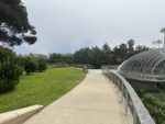
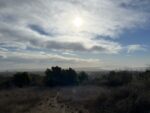
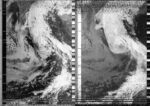
2025-06-15 08:43:21
Steve Engelmann
Pacific Palisades, California, United States
United States
NOAA-15
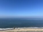
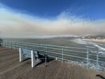
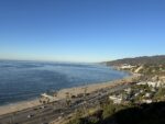
This was the first morning this summer that didn't start off under a marine layer. At the time of capture (08:43am) it was 20°C and will warm up to 27°C. Warm enough to push the marine layer out to the ocean. I could easily hear the waves crashing on the shore, as if I was on the beach. Early on a Sunday morning, the scene was very calm and tranquil.
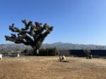
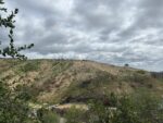
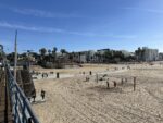
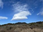
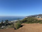
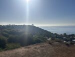
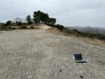
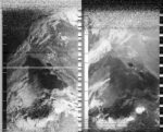
2025-06-14 10:59:40
Steve Engelmann
Santa Monica Mountains, United States
United States
NOAA-19
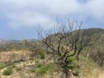
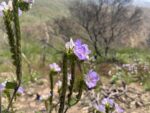
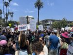
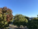
From a trail in the Santa Monica mountains just above Pacific Palisades I captured this satellite pass. The marine layer is beginning to burn off a little earlier in the day. What used to be a charred landscape just a few months earlier is now mostly covered with some plant life. Fresh growth is emerging from the base of many shrubs (chamise, laurel sumac, elderberry) as the roots are still very much alive. Coastal morning glory climb up burnt skeletons. Many bees take sips from large-flowered phacelia.
Meanwhile a "No Kings" demonstration in Santa Monica attracted thousands of peaceful protesters.
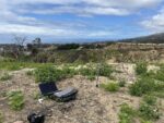
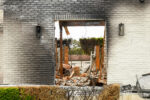
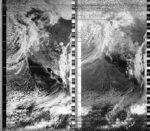
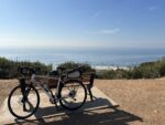
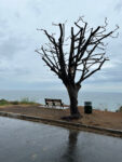
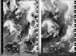
2025-06-01 12:01:44
Steve Engelmann
Pacific Palisades, California, United States
United States
NOAA-18
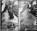
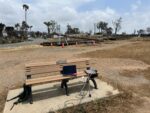
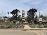
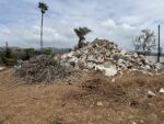
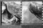
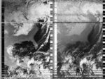
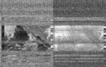
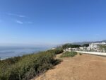
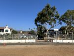
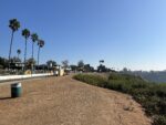
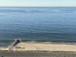
Today I returned to a spot on the bluffs of Pacific Palisades. I did a satellite capture at the same location on November 5, 2024 - the day of the US presidential election. While this location has a great view of the ocean, the early few minutes were problematic as there was a large eucalyptus tree blocking the northern horizon. The Palisades fire burned the foliage of that tree, but eucalyptus are know to tolerate fire. On the first image the tree looks like a fuzzy character from Dr. Seuss. The second image is looking up Temescal Canyon, one of the main access roads to the community. The four lanes are currently blocked to car traffic as it is being used to process and sort debris being removed from fire-damaged homes. The third image is from November 5th. It is interesting to compare the status of the road, the hillside homes and the mountains in the distance. The last image is towards the west with Malibu peaking out of the marine layer.
So much has transpired since the US election. Being ruled by billionaires has not been fun. Somehow I think they believe their wealth is a validation of their political ideology. Between the tariffs (taxes on Americans), the dismantling of government agencies, immigration anxiety, a shift away from science-backed health and environmental policy, the decline of reproductive rights, the instability of the US dollar, the general xenophobia and so much more, it scary that we aren't even 6 months in.
Perhaps what we are witnessing is the burning down of our country. Maybe the rebuild will offer opportunities to reimagine this country. It is hard to watch.
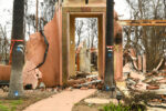
2025-05-24 12:02:37
Steve Engelmann
Pacific Palisades, California, United States
United States
NOAA-18
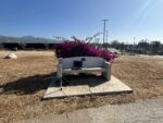
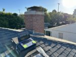
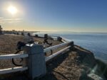
Today's capture was from the Palisades Bluffs. Growing up in the area, I spent many hours staring out at the ocean and contemplating whatever the topic du jour happened to be. Behind me were many piles of rubble and green gardens steps away from ash and a standing chimney. Below the bluffs there is, or was, a trailer park. There was a nonstop cacophony of jackhammers, the sound of trucks backing up, and the rumble of debris falling into a dump truck. More thoughts to contemplate.
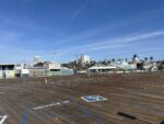
2025-05-21 11:01:34
Steve Engelmann
Santa Monica, California, United States
United States
NOAA-19
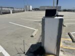
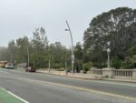
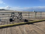
Today I went to the top level of a parking garage next to the Sears building in Santa Monica. It was a beautiful view with clear skies. I was joined by a twenty-something who was using the empty lot to work on his skateboard skills. He also paused a few times to shout some indistinguishable words to someone below. Then he left.
2025-05-09 11:51:30
Steve Engelmann
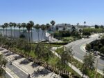
Tongva Park, Santa Monica, California, USA, Earth, United States
United States
NOAA-18
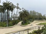
This satellite pass had a slightly better elevation than the earlier one. The marine layer is starting to fade. The pass was captured from Tongva Park (in honor of the indigenous peoples of coastal southern California). During most of the satellite capture a woman was loudly ranting at a police officer. Sometimes I feel like ranting too. Under the topic of "government efficiency" defunding the EPA's Energy Star program is the latest casualty. The program costs the government $32 million, while saving American consumers $40 billion annually. Maybe I missed something on efficiency, but that sounds like for every dollar the government spends on the program, consumers benefit $350. California's goal of selling only new electric vehicles by 2035 is also up in the air. And the defunding of NOAA may also result in NOAA 18 being turned off. From space, everything seems so peaceful. I guess appearances may deceive.
2025-05-09 08:11:58
Steve Engelmann
Sears, Santa Monica, California, United States
United States
NOAA-15
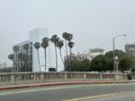
The call it May Gray (and then later June Gloom). It is a typical marine layer that hugs the coastline in late spring/early summer in southern California. The clouds usually "burn off" by noon and return in the evening. I found a nice spot on a bridge near the Santa Monica pier. The 10 fwy passes under and the historic Sears building stands nearby. The high school I teach at partially burned in the Palisades Fire. The Sears building has become our temporary school site. The sidewalk on the bridge is narrow. A number of students and teachers squeezed by as I was doing the recording. Only one teacher paused to ask me what I was doing.
2025-04-27 11:03:55
Steve Engelmann
Pacific Palisades, California, United States
United States
NOAA-19
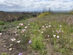
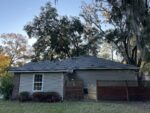
On January 7th I captured a satellite pass in the foothills of the Santa Monica mountains. The winds were wild and within an hour of the pass the Palisades Fire had started. Today I returned to the same location almost 4 months later.
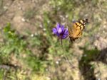
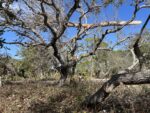
The wind was gentle. It was cool as a light storm had passed the day before. In the distance there was the constant beeping of trucks backing up and the rattle of jackhammers. While the Palisades suburbs were a long way from recovery, the natural landscape seemed rejuvenated. This is a fire-climax biome. The tops of the shrubs (chamise, laurel sumac, coyote bush, and elderberry) were blackened, but from the base sprouted eager green shoots from the living roots. Many young wildflowers were present (mariposa lily, blue dicks, california brittlebush, bird's-foot trefoil and invasive black mustard). In my view, however, the clear winner is the wild cucumber. Early after the first rains, the cucumber took advantage of the lack of competition. Blackened hillsides turned green (and white flowers) as the vines stretched out in all directions. Many cucumber fruits are already the size of baseballs.
2025-04-27 08:24:59
Steve Engelmann
Santa Monica Pier, United States
United States
NOAA-15
A typical April morning at the Santa Monica pier. A gentle breeze with a high of 16°C. A group of about 20 people gathered near me as I captured the satellite pass. They all wore a paper number pinned to their shirt. My guess is that there was some kind charity run/jog with the pier as the end point.
2025-04-15 11:59:24
Steve Engelmann
Pacific Palisades, California, United States
United States
NOAA-18

It has been over 3 months since the start of the Palisades Fire. I did a satellite capture less than an hour before the beginning of the fire on January 7th. I thought I would return to that location to do another capture. Road closures forced me to change plans. As the satellite was about to rise above the horizon, I found myself in the middle of the residential burn zone of the Palisades. With few trees standing, and even fewer homes, the skyline was favorable for a clear view of the sky. I found a convenient wall from a burned property to place my laptop. Several cars slowed during the pass giving me suspicious looks. Who is this man with an antenna in the middle of all the destruction? One car lingered for several minutes - I feel I was being filmed.
Meanwhile, we live in the chaos of tarrifs, the deportation of students with political views, the defunding of universities and the promise to increase domestic energy (fossil fuel) production. Later that day I attended a press conference at City Hall promoting the Polluters Pay Climate Superfund Act of 2025. The odds are long, but the effort is important.
2025-03-08 10:45:22
Steve Engelmann
Santa Monica Pier, United States
United States
NOAA-18
Captured a satellite pass today from the Santa Monica pier. Sunny and 16°C, a typical March day. Two months after the fires that leveled most of Pacific Palisades it is hard to tell anything happened in the rest of the LA area. The pier is full with the usual sight-seers. Bike riders and volleyball payers do what they do. You have to know where to look for the evidence. At the water's edge interesting patterns are made of burned vegetation and ash. The new presidency is hard at work making us look the other way with declarations of the Gulf of America and Mount McKinley. Apparently in America there are now only two genders. Meanwhile thousands of government jobs and agencies are being canceled. Services related to education, the National Parks and medical research are no more. And the Coast Guard Academy can no longer mention climate change in any of their trainings.
2025-02-15 09:54:38
Steve Engelmann
Santa Monica Pier, United States
United States
NOAA-19
Mostly sunny skies and 16°C - pretty normal for a southern California February. After 8 months of no rain, the last 3 weeks has helped to finally put out the fires and bring the area out of fire danger.
2025-01-26 11:06:49
Steve Engelmann
Santa Monica, United States
United States
NOAA-18
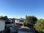
I went to the top of a parking garage in downtown Santa Monica in the hopes of having a clear view of the sky. I didn't get as clear of an image as I hoped for. Perhaps some interference from the surrounding buildings, etc.
Today was the first meaningful rain event for almost 9 months. This has been the driest start of the rain season since records began in 1877. Not a surprise when 3 weeks ago dry winds conspired in the development of six fires burning simultaneously around Los Angeles. 28 lives were lost and over 16 thousand homes destroyed. The human fingerprint is all over this event from the initial ignition, the preparation and response from the fire department, housing development within a flammable ecosystem, and ultimately, the climate crisis. A lot of finger pointing from the new president to the individual. Will there be any meaningful change? This will happen again.
2025-01-19 10:54:52
Steve Engelmann
Studio City, California, United States
United States
NOAA-18
This pass was captured from the Hollywood Hills facing the San Fernando Valley. My friend Henry helped out. There were some large power cables just overhead which I suspect created a little interference initially. The skies were a bit hazy, which is a big change from just the day before. I do not think this is related to the fires as they are mostly contained at this point and not actively burning.
2025-01-11 10:56:21
Steve Engelmann
Santa Monica Pier, United States
United States
NOAA-18


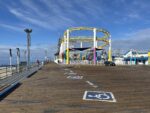
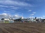
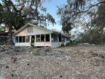
This is day 4 since the Palisades Fire began and it has been quite the rollercoaster. Regardless, NOAA 18 decided to fly over with an elevation of 89°. You don't get much better than that. I decided to visit the Santa Monica Pier as it has great exposure to the sky, and is about as close as I can get to the fire zone. One of the top destinations for tourists, there was much activity. A bodyboarder screams as he catches a wave. The rollercoaster operator ask his riders if they want to go for a second spin. A neon sign above a cafe reads, "Salty air, and not a care".
On a small island of homes, my house defied all odds - standing strong. My classroom of 25 years went up in smoke. About 6 1/2 minutes into the satellite pass you can see a thin strip of clouds headed out to the ocean. The winds have died down, but the fire continues. At just 11% containment, it is now threatening Brentwood and Encino. 8 months of no rain and some strong winds. It doesn't take much to change your course.
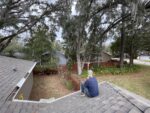
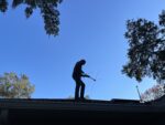
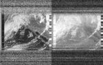
2025-01-07 09:39:57
Steve Engelmann
Pacific Palisades, California, United States
United States
NOAA-19
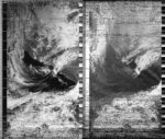
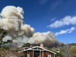
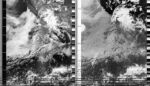
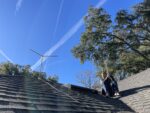
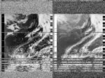
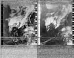
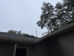
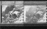
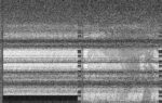
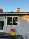
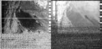
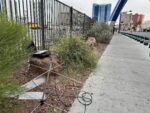
Today is a blustery day in Los Angeles. The National Weather Service predicts a "life-threatening and destructive" windstorm, with gusts of wind up to 160 kph. Over the last 8 months, southern California hasn't received a rainfall event with more than a few millimeters of precipitation. The landscape is dry and the humidity is expected to drop (currently 20%). A spark from a power line can ignite the extremely flammable brush and then carry embers great distances. "Fire season" used to refer to late August, September and October. In recent years, some of the worst fires in California history happened in November, December and January. With a changing climate there is a need to update our terminology.
While some people might think this is an excuse to hunker down and ride out the storm, I thought this is a reason to break out the antenna. I went up into the hills of the Santa Monica Mountains and captured a pass.
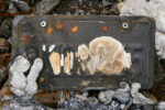
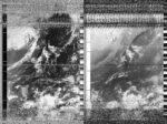
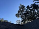
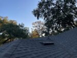
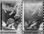
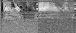
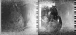
While writing this weather note, I started hearing sirens. A neighbor sent me a text. I hopped on my roof and watched flames come over a ridge (see image 3). Ended up evacuating due to air quality.
2025-01-03 10:58:05
Steve Engelmann
Pacific Palisades, California, United States
United States
NOAA-18
It is hard to pass up an opportunity when a satellite is passing by with an elevation of 87°. Back in Los Angeles I thought I would try out roof-top parking for an unobstructed view. The skies were mostly cloudy with a cool marine layer bringing in a little fog. There was also a light scattering of stratocumulus and high cirrus clouds, but no precipitation. The Air Quality Management District initiated an Air Quality Alert. An inversion layer, which is common in LA, traps air pollutants low to the ground. For this reason there is a ban on wood burning. The fine particulates get deep into lungs and can trigger a range of health issues. Could use some rain, but nothing in the forecast for the next 10 days.
2025-01-02 10:19:52
Steve Engelmann
Newberry, Florida, United States
United States
NOAA-19
Went out to capture a satellite pass with a super high elevation (87°). Found an abandoned golf course in the process of being repurposed with a relatively clear skyline. The skies were mostly clear with some cirrus clouds toning down the sunlight. It was a crisp 10°C at 10AM, which seems a bit unexpected for someone not from Florida. Just at the satellite was at it's highest point, an airplane left a contrail, as if to mark the spot.
2025-01-01 10:33:00
Sasha Engelmann
Steve Engelmann
Gainesville, Florida , United States
United States
NOAA-19
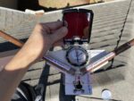
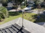
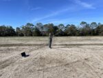
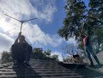
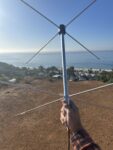
Today marks the official permanent installation of the Gainesville Automatic Satellite Ground Station on the roof! We did one more test of two AGS's (15 and 12) running in parallel and receiving the same satellite shortly after 10:30am from the roof. Both received stunningly clear images, even though the pass was only around 65 degrees at max elevation. One V-dipole was mounted on the permanent installation site, and Steve held the second. The former received an image with less interference, which made sense, given it had nothing around it to possibly affect the antenna's radiation pattern. After drilling a pilot hole through the PVC that holds the antenna to the (now waterproof) wooden mast, we used a wood screw to solidly connect the two. We stretched out the RG8X coaxial cable throughout the backyard to make sure there were no kinks, and screwed one end into the base of the antenna on the roof, using zip ties to hold the cable against the mast. Following one edge of the roof, we bolted the cable down with small cable brackets, and looped it under the garage door overhang, following the edge of the moulding around the door to the floor, where we hooked it under a piece of wood. Steve drilled away some of the wood on the inside part of the garage door corner, where we passed the cable through to the inside, testing the garage door could open and close without causing any friction. We then bracketed the cable to the moulding along the bottom of the garage wall to the corner where there is a work desk and a power plug. We had a good metre and a half of cable left, and gently looped this around twice. After the cable was stretched out and secured, we returned to the roof, where we oriented the V-dipole to 'true north' using a professional compass, which meant we had to apply a 6 degree West declination (based on the difference between magnetic North and true North from our position in Florida). One of us oriented the antenna with the compass while the other screwed the wooden mast tightly into the steel mount with two screws. We also wrapped the UHF connector at the end of the coaxial cable with some vinyl electrical tape to protect it from UV radiation and water damage. Back inside, we cleaned up the wood shavings, glue, and spare screws. As we didn't have any extra 3D print casings for the Florida AGS, we DIY-ed a small cardboard box, and hooked up AGS 15 in its corner. It lit up, and let us know that it was going to collect a NOAA-15 pass shortly before 7pm this evening!
2024-12-31 11:14:24
Steve Engelmann
Newberry, Florida, United States
United States
NOAA-18
Got up on a roof in central Florida with my nephew to do a little training and compare two different antennas on a satellite pass. The sun came in and out of the clouds often. Combining the warm December temperatures, humidity and the dark roof surface I came down a little sweaty.
On the last day of 2024 it is always interesting to assess the year that just passed and contemplate what lies ahead. 2023 was the warmest year on record regarding global temperatures. The consensus is that 2024 will end up being warmer still. At this moment there is a polar vortex sending frigid temperatures to the midwest and northeast. Ironically, climate change makes these events more likely. Searching for opportunities to dial down carbon emissions would be a great new year's resolution.
2024-12-30 11:28:00
Sasha Engelmann
Steve Engelmann
Gainesville, Florida , United States
United States
NOAA-18
We were late in plugging-in the semi-permanently mounted V-dipole antenna to the 'recording' AGS, but happy to see it standing on the peak of the garage roof, glinting orange-pink in the sunlight, without anyone attempting to hold it in place, as it received an image from NOAA-18. After several antenna radiation pattern calculations, we decided to try a test antenna height of 0.8 metres off the pinnacle of the roof. While some radio forums suggest putting the antenna as high as possible, others suggest this is not necessary, especially if one is already mounting on a semi-conductive wooden roof (as opposed to concrete or steel). Depending on what surface the v-dipole antenna takes as 'ground', the antenna height can create different patterns of reception, and can even lead to 'null' points where no signal data can be received. However, as Gainesville can get very strong, hurricane force winds, and we couldn't see many examples of tall antennas or rooftop weathervanes in the neighbourhood, we opted to keep the antenna height under one metre, and 0.8 seemed to work great today, despite our lateness. To secure the antenna mast to the roof, we used a steel 'weathervane' mount with special wood screws with deep ribbons that we had gotten at the local ACE hardware store, and a good coating of a transparent sealant gel called, somewhat counter-intuitively, 'Through the Roof!' We managed to hit a stud with one side of the steel mount, which was a good sign for the sturdiness of the antenna, but also meant that the drill pushed further into the roof on the stud side of the mount, and slightly unbalanced the mount. We unscrewed, knocked some wooden 'shims' under the metal pad at the stud side, and checked its straightness by hanging a roll of tape on a golden ribbon next to the mast. Tomorrow, hopefully, we will be able to tie the RF cable onto the mast, and bracket / secure the cable to the roof, wrapping it around the edge of the garage door and entering the garage where the AGS will stay plugged in.
2024-12-29 11:41:00
Sasha Engelmann
Steve Engelmann
Gainesville, Florida , United States
United States
NOAA-18

A huge amount of progress was made today with AGS reception! It is hard to contain the excitement while writing this weather note. After several months exploring ‘herringbone’ distortion patterns and deep diving into NOAA APT + Raspberry Pi tutorials, the team found an ‘instructable’ tutorial via which several people seemed to be receiving relatively long and clear NOAA images. In this tutorial, Grayson noticed a filter option for rtl_fm called -F 9 that we hadn’t tried to implement in the AGS code yet, and he added it in an update yesterday. Last night, the roof mounted turnstile in Florida had to be taken down due to a lightning storm and ‘extreme’ tornado warning. Yet even though it was up against a garage wall and under an overhang, the last evening pass of the day yesterday showed telemetry data at the top and bottom of the image, where previous captures only recorded static.
This morning, despite an ongoing storm and tornado warning, the Turnstile was positioned out on the front lawn for a 70 degree max elevation pass shortly after 11:40. In stark contrast to previous ‘letterbox’ type images in which satellite data only appeared in the central strip of the recording, today the image is significantly longer and clearer, with telemetry data clearly showing through static at the beginning and end of the pass. Also, the typical ‘herringbone’ type distortion seen in all previous images appears to be gone! More testing will verify this but at present this is something to celebrate.
2024-12-28 11:53:14
Sasha Engelmann
Steve Engelmann
Gainesville, Florida , United States
United States
NOAA-18
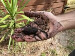
To continue our antenna comparison, we sat on the roof shortly before noon with a weatherised V-Dipole and the tripod- mounted Turnstile, looking north. The V-dipole was hooked up to AGS 15, while the Turnstile received via an android phone running SDR++. The image attached to this post is from the latter. After the pass, Steve did a soil texturing test which revealed the local soil to be ‘loamy sand’.
2024-12-27 09:56:00
Sasha Engelmann
Steve Engelmann
Gainesville, Florida , United States
United States
NOAA-19
We joked that Orlando kept getting farther away as we drove south on 75, east through Ocala National Forest, over the waters of Lake Monroe, and alongside cattle pastures and skeleton scarecrows. Rain splattered intermittently on the windshield. Billboards declared that ‘at 18 days since conception, a baby’s heart is already beating’, or ‘man up: your child needs you.’ An entire single story house rolled down the highway taking up two lanes, flanked by pickup trucks. A corner ‘yard art’ shop burst with bronze eagles, brown bears, American flags and an original Bob’s Big Boy sculpture, complete with a checkered red and white outfit and a sculptural hamburger on a plate.
2024-12-26 10:08:00
Sasha Engelmann
Steve Engelmann
Gainesville, Florida , United States
United States
NOAA-19
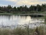
Florida balances over one big aquifer: a hidden cavernous water system fed by rainfall that stretches beneath the everglades, wetlands and an ecological system known as 'moist sandy pine / hardwood woodlands'. Walking through the Sweetwater Wetlands south of Gainesville yesterday, we met some of the water on its way into the depths. Today, at Rainbow Springs, an hour further south, we saw some of it come out, bubbling up through pale white-gray sand, so abundantly that it creates the Rainbow River, a wide, flat river sustaining alligators, turtles, catfish, frogs, coral snakes and other wildlife. Rainbow Springs exists because of the thinner karst rock separating the aquifer from the surface, while elsewhere in the state, the rock-shield is much thicker. The upwelling makes the water below feel very close, even reachable, but we learned that the water in the Floridan Aquifer is between 17,000 and 26,000 years old. The springs seemed otherworldly in their crystal clear shallows, ferns and mossy trees, and two impressive waterfalls cascaded over towering rocks. One of the waterfalls was named 'Seminole Falls', after local Indigenous peoples who never ceded their land. We speculated that the two tall waterfalls might have been built up as the upwelling spring water deposited minerals over thousands of years. Later a park ranger informed us that the waterfalls were entirely man-made in the 1930s, created with sediment dredged from the bottom of the springs, and that water has been power-pumped to the top of the rocks for decades, just so visitors can watch it fall.
2024-12-25 10:22:00
Sasha Engelmann
Steve Engelmann
Gainesville, Florida , United States
United States
NOAA-19
"What is this obsession with 'manned' or 'unmanned'?!" jokes Bowen Yang, playing 'A Drone' on Saturday Night Live. "For the record" Bowen continues "I can get a man whenever I want!". The skit plays on political divisions haunting thousands if not millions of American Christmas Eve dinners this year. I had not heard about the reported drone sightings prior to arriving in Florida, but they have been raised by local family members at every opportunity. "What is the government really doing?" "Remember the media explosion about that one Chinese balloon?! Now there are hundreds of drones and no one is talking about it!" Or, "I just worry about what could happen in New York on New Years Eve". Earlier in the week, when Steve and I set up the turnstile antenna on the roof of my Mom's house, a family member walked over and asked if we could listen to the drones. I decided to preserve a bit of mystery: "this is for satellites, but both satellites and drones communicate via radio waves".
2024-12-24 10:34:00
Sasha Engelmann
Steve Engelmann
Gainesville, Florida , United States
United States
NOAA-19
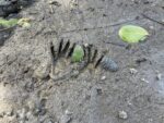
After a few hours at Florida's coast, one begins to see beyond the obvious signs of damage from Hurricane Helene to houses and infrastructure, and other more subtle signals become visible. At the edge of the marshes in Suwannee, a town at the mouth of the Suwanneee river, the land had subsided significantly. We spotted a red life jacket caught in top of a stand of high reeds near the waterline. Near the Cedar Keys museum, a bleached log had been lifted into the upper branches of a Cedar or Juniper. "Have a good time on the island- or what's left of it" said a Cedar Keys resident named Tom as we left the community garden he had set up and repaired from storm damage. We noticed how local mud clams grow in clumps, clustering on each other, rather than on rocks, like the clams and mussels of California and the UK. In the mud, the footsteps of boots traced a path to a dense outcrop of clams, presumably for a local clam harvest. Raccoon feet looked like tiny hands sunk deep in the mud. "When I was young we all used to go clam stomping" said a woman we spoke to in Cedar Keys. "You would stand in the mud and stomp your feet down over the clam. They were huge" she made a sign with her hands, fingers arranged in a large diamond shape, "nothing like what we eat today", she added.
2024-12-23 11:17:00
Sasha Engelmann
Steve Engelmann
Gainesville, Florida , United States
United States
NOAA-18
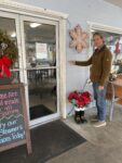
"How high did the water get?" asked Steve. Our waitress silently walked to the door of 'Steamers' cafe and pointed to a green line drawn on the wall above chest height. "The previous high water level was all the way down here" she added, bending all the way down to a wave pattern drawn with Sharpie about a foot off the ground. "Then Idalia was here" she said, referencing the 2023 Hurricane, and pointing to a black mark around two feet off the ground, not far from the lower mark. "We prepared for it to be somewhere in between" she said. In the midst of the bustling cafe at lunchtime, we all took a moment to look at the marks on the wall in silence. The distance between the water level that the town of Cedar Keys had prepared for, and how high the water rose during Hurricane Helene, was almost unbelievable.
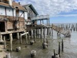
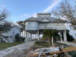
Later, driving through Suwaneee, another Gulf-side town north of Cedar Keys, we saw tree branches hoisted into upper tree branches, boats that appeared to have been lifted and dropped in driveways, broken windows, boarded-up holes, and debris still clinging to the upper branches of palms, cedars and other bushes. The newer houses were built on stilts 16 feet high or more - the new 'code' for building, we had learned from the waitress.
2024-12-23 10:47:00
Sasha Engelmann
Steve Engelmann
Gainesville, Florida , United States
United States
NOAA-19
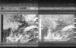
2024-12-22 11:29:00
Sasha Engelmann
Steve Engelmann
Patio Homes, Newberry , United States
United States
NOAA-19


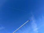
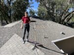
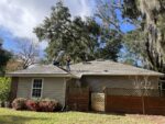
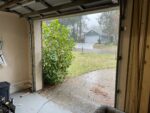
Day 1 of the Florida Automatic Ground Station testing phase. A turnstile antenna is taped to a tripod sitting on the angle of the roof. An RF cable runs through a crack in the garage window to the AGS on a worktable inside.
2024-12-21 11:40:57
Sasha Engelmann
Steve Engelmann
Old golf course next to W Newberry Road, Gainesville, United States
United States
NOAA-18
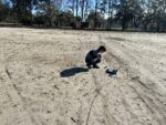
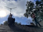
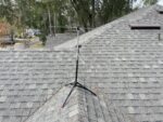
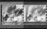
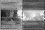
A clear, cool, breezy day here in Florida. We stand on separate hills in the former golf course, one of us with a turnstile antenna, another with a v-dipole. Later, comparing images, we notice how there is a clear line at the midpoint of the turnstile's image that doesn't appear in the image made with the dipole. This line is appearing at almost the same spot in previous images collected with the same laptop and antenna - a signature of the laptop? or a glitch in antenna reception, at the peak of the satellite pass? Later in the day, we test the same antenna from the roof, shaded by southern live oaks. As there is no wind or rain predicted, we tape it to an old camera tripod found in the garage, simply stand it up on the roof's apex, and run a cable through a crack in a window.
2024-12-15 09:26:13
Steve Engelmann
Pacific Palisades, California, United States
United States
NOAA-19

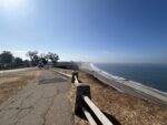
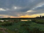
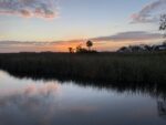
The view from the bluffs was a sunny and calm Pacific Ocean with only a distant layer of low clouds hugging the horizon. A fifteen minute drive north along the coast would take you to Malibu where roads are closed due to the Franklin fire. A week earlier a fire erupted late at night. 8 homes were burned as Santa Ana winds gusted to 100 kph and humidity levels dropped to 5%. Pepperdine University was completely surrounded. The fire stands at 43% containment, but dry winds are expected to return in a few days. In November of 2018, the Woolsey fire burned 97,000 acres in just a few days. The term "fire season" has little meaning at this point. Insurance companies have been refusing to write new policies due to the increased risk of loss due to the changing climate. This last week California agreed to allow insurance companies to increase their premiums in response to the new climate reality.
2024-12-13 17:53:00
Los Angeles AGS
Los Angeles, United States
United States
NOAA-19
2024-12-07 05:01:00
Los Angeles AGS
Los Angeles, United States
United States
NOAA-19
2024-12-05 17:52:00
Los Angeles AGS
Los Angeles, United States
United States
NOAA-19
2024-12-04 06:13:00
Los Angeles AGS
Los Angeles, United States
United States
NOAA-18
2024-12-03 18:51:00
Los Angeles AGS
Los Angeles, United States
United States
NOAA-18
2024-12-02 15:32:00
Los Angeles AGS
Los Angeles, United States
United States
NOAA-15
2024-11-28 09:37:09
Steve Engelmann
Venice, California, United States
United States
NOAA-19
Went out to the Venice Pier to capture a satellite pass on Thanksgiving. From the image it looks like blue skies for the entire California coast. The pier was busy with sport fishermen. One approached me and asked me if I was looking for aliens. The aliens he was referring to, however, were not extraterrestrials. He was suggesting that immigrants were coming ashore via boats at night. We I explained that the NOAA-19 satellite was harmlessly taking our photo, he suggested we all give it the finger.
Sarah Josepha Hale had been campaigning for decades that the US celebrate Thanksgiving. In 1863 she finally convinced Abraham Lincoln to make the last Thursday in November a national holiday. In the midst of the Civil War, it was intended to find common ground and unify the country. Many Americans express anxiety at sitting down with relatives and navigating the inevitable awkward conversations. Sometimes I wonder if I am the "crazy uncle" at the table.
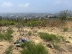
2024-11-26 10:37:48
Steve Engelmann
Topanga, California, United States
United States
NOAA-18
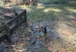
Captured this satellite pass from a helicopter landing site on a ridge of the Santa. Monica mountains with the San Fernando Valley to the north and the Pacific to the south. From the overlook you could see small patches of light precipitation. I was visited by a curious crow and a grizzled hiker. The hiker had more questions.
2024-11-26 06:15:00
Los Angeles AGS
Los Angeles, United States
United States
NOAA-18
2024-11-21 07:17:23
Steve Engelmann
Pacific Palisades, California, United States
United States
NOAA-15
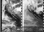
Took another satellite capture from the bluffs over-looking the Pacific Ocean. Over the last couple of days a "bomb cyclone" formed and is making landfall in the Pacific Northwest. The name comes from how fast the storm developed. Heavy rains and strong winds have hit Washington state already. A few lives were lost to falling trees. From the image you can see a tail of the cyclone that might bring some precipitation to Southern California in the next few days.
While recording the pass a construction worker came over for a chat. He asked if I was recording aliens. I later pulled up a hotspot, decoded the wav file and showed him the image. He then asked me if the world is really round or flat. I guess sometimes it is however you want to see it.
2024-11-17 10:52:00
Steve Engelmann
Venice Beach, United States
United States
NOAA-18
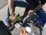
Went to capture a satellite pass from the Venice Pier. Beautiful blue skies. The pier is covered with tourists, fishermen and many spectators watching the 40 plus surfers on both sides of the pier. A number of people approached me curious about what trouble I was into. There was a family with three small children from Italy, a pair of senior citizens and a guy named Sidney. All were dazzled with the antenna and the concept. To complete the magic trick I used my phone as a hotspot and decoded the wav file live. The audience was impressed.
Two weeks after the election the news is full of the latest on the cabinet picks for the next administration - an anti-vaxer in charge of health, a former oil executive to regulate fracking, and an alleged sex-trafficker to run the justice department. I wish I believed in magic.
2024-11-11 09:49:13
Steve Engelmann
Pacific Palisades, United States
United States
NOAA-19
Looking out over the Pacific Ocean on another beautiful day. City crews are busy behind me trying to stabilize the bluffs from their relentless slide towards the ocean. Multimillion-dollar homeowners are in denial of the inevitable, attempting to resist the forces of nature. It has been nearly a week since the election. Trying to find my tribe. Spent most of my Saturday with Climate Strike LA. This morning it was a zoom meeting with Human Rights Watch. Concerned, but feeling the energy. We too shall resist.
2024-11-09 07:33:11
Steve Engelmann
Pacific Palisades, California, United States
United States
NOAA-15
In the wake of last week's national election I've been trying to find silver linings among the chaos and wild projections over what the next four years will bring. My email feed has been flooded with requests from environmental/social justice NGOs. Apparently membership and donations increased during the last time this happened. In blue California there are pockets of red. Beverly Hills High School needed to institute new regulations to tone down celebrations by teens. Monday is the beginning of the next climate conference - COP 29. The tone of the conference will pivot widely on the election results. Curious to see what, if any, strategies arise. Hopped up on my roof this morning to capture NOAA 15. Seems as if some power lines interfered with the end of the pass.
2024-11-05 07:32:33
Steve Engelmann
Pacific Palisades, California, United States
United States
NOAA-15

As the sun rises over the western US, the national election is in full swing. Regardless of the outcome, about half of the US adult population agrees with a candidate who thinks the climate crisis is a hoax played by the Chinese government. As president he pulled the US out of the Paris Accord and promises to resurrect the coal industry. Two days before the election he stated that the cool weather in Pennsylvania was "evidence". Looking out upon the calm Pacific Ocean hasn't done much to calm my nerves - yet.
2024-11-03 10:29:57
Steve Engelmann
Red Rock Conservation Area, Nevada, United State, Nevada
United State, Nevada
NOAA-18
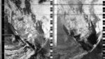
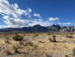
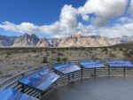
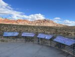
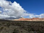
The Red Rock Conservation Area, just outside of Las Vegas, has been a work in progress for over 500 million years. It has seen oceans, sand dunes, the formation and dissolution of supercontinents, mass extinctions, indigenous peoples and more. Midway through the satellite capture sudden strong winds blew away my notes (later retrieved) and nearly capsized my laptop from a precarious railing (I should make better choices in the future). I was stabilizing my computer against the wind with one hand, tracking a satellite with the other and trying to convince some humanities academics from Chico State that the extraterrestrial I was following was benign - all in preparation for my audition at the 3-ring Circus. On the time log of Red Rock Canyon us humans will be nothing more than a minor footnote. What mark shall we leave on the geologic record?
2024-11-02 08:10:31
Steve Engelmann
Las Vegas, Nevada, United States
United States
NOAA-15
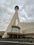
8am on a Saturday morning outside the Strat casino in Las Vegas is pretty quiet. Few cars, but a disheveled man with many tattoos asked me if I was communicating with aliens. When I told him I was receiving an image from a passing NOAA satellite, he seemed interested - but not enough for a conversation.
2024-11-02 11:41:15
Steve Engelmann
Near Nelson ghost town, Nevada, US, Nevada
US, Nevada
NOAA-18
On my way to my nephew's wedding I pulled over near the Colorado River for a satellite capture. There has been controversy regarding who gets to use the Colorado River water. California has gotten the lion's share mostly, but the quantity has been declining for several decades and sometimes it doesn't reach Mexico. The best of plans get ruined when there isn't enough water. All the best wishes to Chris and Heather.
2024-10-27 10:35:55
Steve Engelmann
Pacific Palisades, California, United States
United States
NOAA-19
In a late morning pass overlooking the Pacific from some neighborhood bluffs. A thin layer of stratocumulus clouds add a calming effect to the Fall and a little more than a week before the US election. Hardly a mention of the climate crisis amid fictitious tales about Haitian immigrants and praise of Nazi generals. Crossing my fingers for a favorable forecast.
2023-08-20 08:34:30
Steve Engelmann
Pacific Palisades, California, United States
United States
NOAA-15
Standing on the bluffs overlooking the Pacific Ocean you could feel the anticipation. Light rain had started and the winds of the incoming storm were beginning. Over 50 years I have spent many hours looking out, working through dilemmas, contemplating, searching for perspective. Today was like no other. Hilary had been down graded to a tropical storm by the morning. She tracked east of Los Angeles and ended up closing down Death Valley with historic floods.
2024-08-01 12:24:05
Steve Engelmann
Geneva, New York, United States
United States
NOAA-18
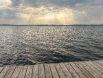
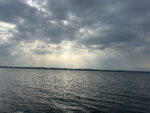
Cloudy with spots of sunlight breaking through. Potential for thunderstorms later in the day. Pleasant view across Seneca Lake.
2024-07-30 08:46:30
Steve Engelmann
Geneva, New York, United States
United States
NOAA-15
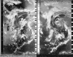
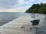
From the docks of William and Hobart Smith Colleges in Geneva, New York the weather was humid, but pleasant, from the shores of Seneca Lake. Powerful thunderstorms were developing for later in the day.
2024-10-13 17:06:00
Los Angeles AGS
Los Angeles, United States
United States
NOAA-19
2021-10-31 10:59:12
Steve Engelmann
Los Angeles, CA, USA
USA
NOAA-18
2020-09-07 03:52:00
Steve Engelmann
Hills of Malibu, CA, USA
USA
NOAA-19
I drove up into the hills of Malibu. It was 41°C. I hope everything recorded correctly. I heard the ticking. I'm very interested to see what it looks like.