Local Date
1 June 2025Local Time
12:01Location
Pacific Palisades, CaliforniaCountry or Territory
United StatesContributor
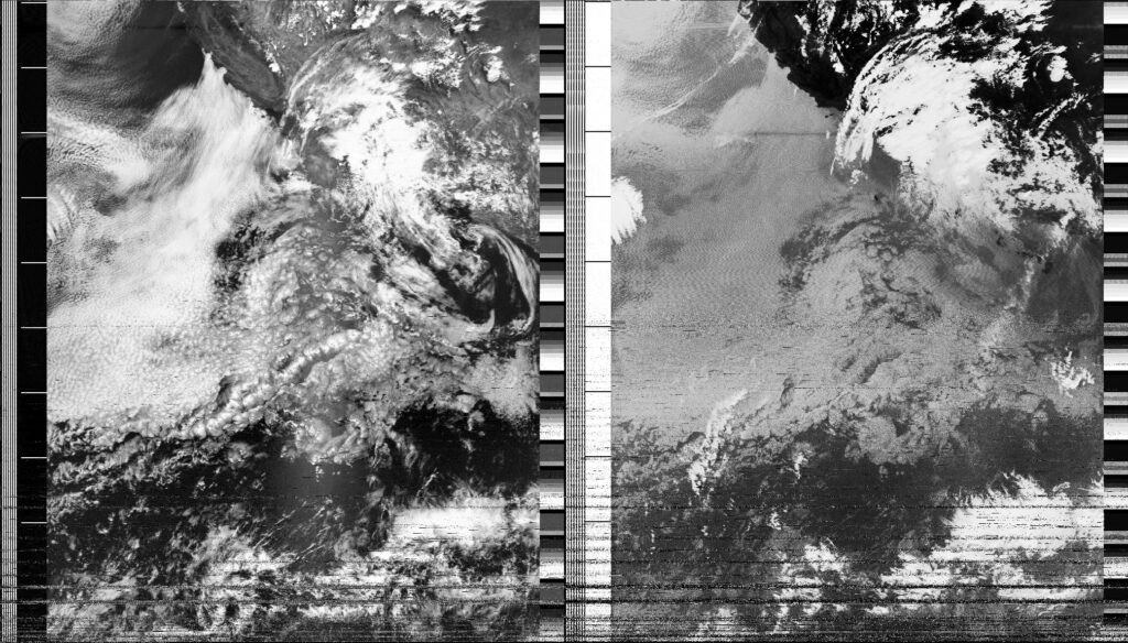
Steve EngelmannSatellite
NOAA-18Archive ID
Coordinates
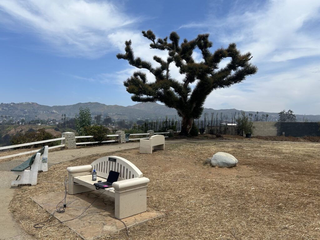
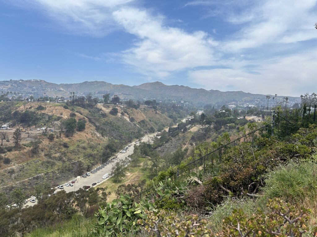
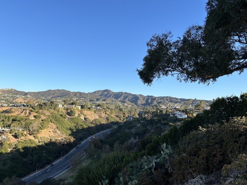
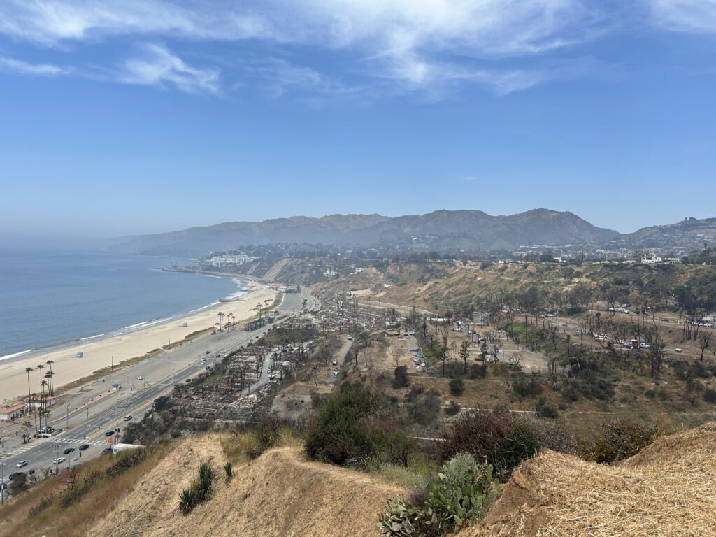
Today I returned to a spot on the bluffs of Pacific Palisades. I did a satellite capture at the same location on November 5, 2024 - the day of the US presidential election. While this location has a great view of the ocean, the early few minutes were problematic as there was a large eucalyptus tree blocking the northern horizon. The Palisades fire burned the foliage of that tree, but eucalyptus are know to tolerate fire. On the first image the tree looks like a fuzzy character from Dr. Seuss. The second image is looking up Temescal Canyon, one of the main access roads to the community. The four lanes are currently blocked to car traffic as it is being used to process and sort debris being removed from fire-damaged homes. The third image is from November 5th. It is interesting to compare the status of the road, the hillside homes and the mountains in the distance. The last image is towards the west with Malibu peaking out of the marine layer.
So much has transpired since the US election. Being ruled by billionaires has not been fun. Somehow I think they believe their wealth is a validation of their political ideology. Between the tariffs (taxes on Americans), the dismantling of government agencies, immigration anxiety, a shift away from science-backed health and environmental policy, the decline of reproductive rights, the instability of the US dollar, the general xenophobia and so much more, it scary that we aren't even 6 months in.
Perhaps what we are witnessing is the burning down of our country. Maybe the rebuild will offer opportunities to reimagine this country. It is hard to watch.