
Automatic Ground Station
Project updates
🚀 March 2025
Four AGS have been successfully deployed in Florida, United States; Pune, India; Vienna, Austria; and Gilboa, United States. These AGS are uploading to the open-weather Public Archive daily.
We are currently working with ground station hosts in Cornwall, UK and Phnom Penh, Cambodia. AGS are on their way to or have already arrived in Valparaiso, Chile; Perth, Australia; Seattle, United States; and Nicosia, Cyprus.
🧪 January 2025
We are nearing the end of an exciting but lengthy testing and debugging phase of the project.
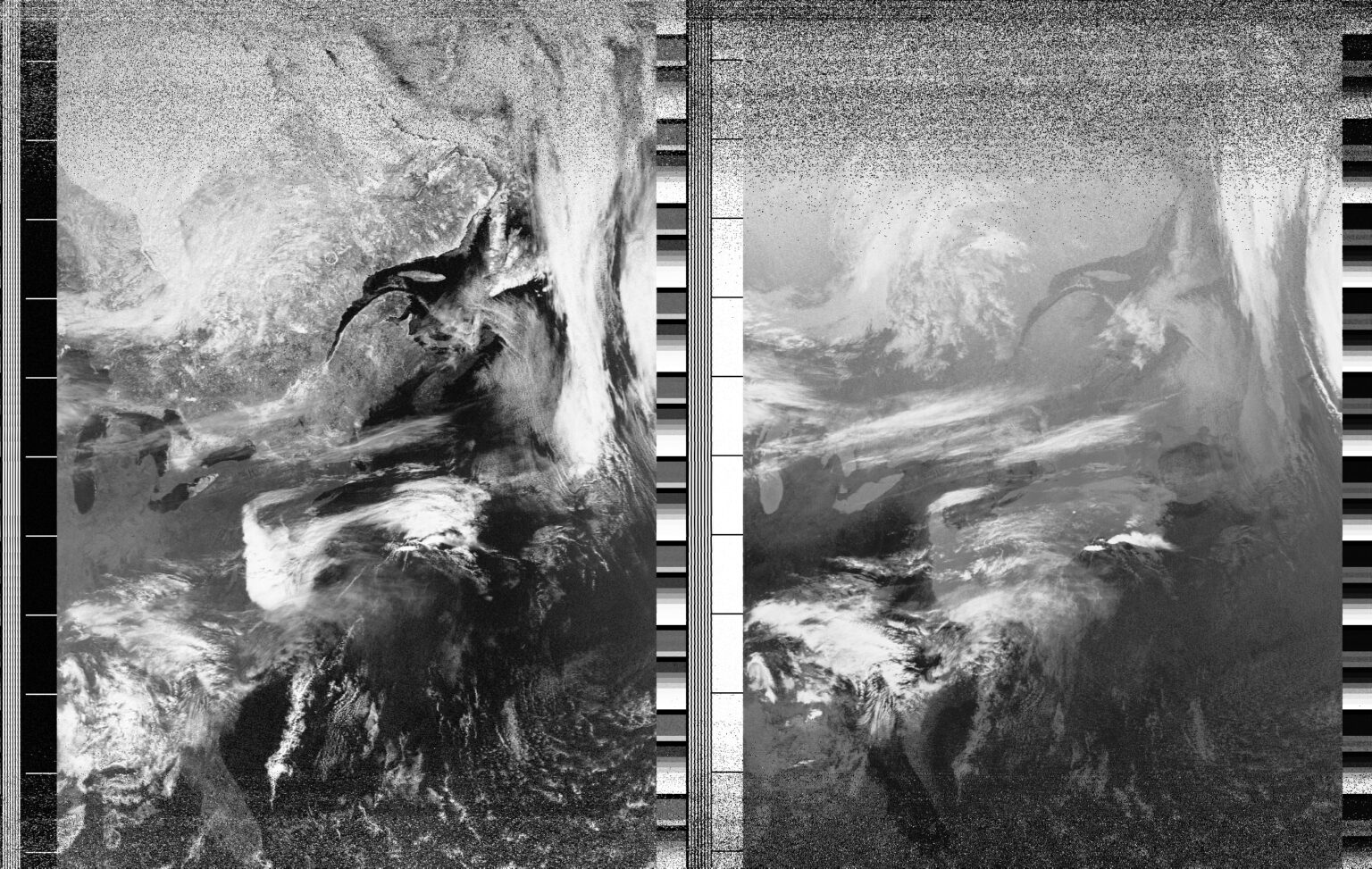
Several AGS prototypes and early devices are already out in the world and uploading daily to the Public Archive. You can view their entries here.
If you would like to get in touch about the project or express interest in hosting an AGS for the Year of Weather or linking your existing ground station to our API, please write to us.
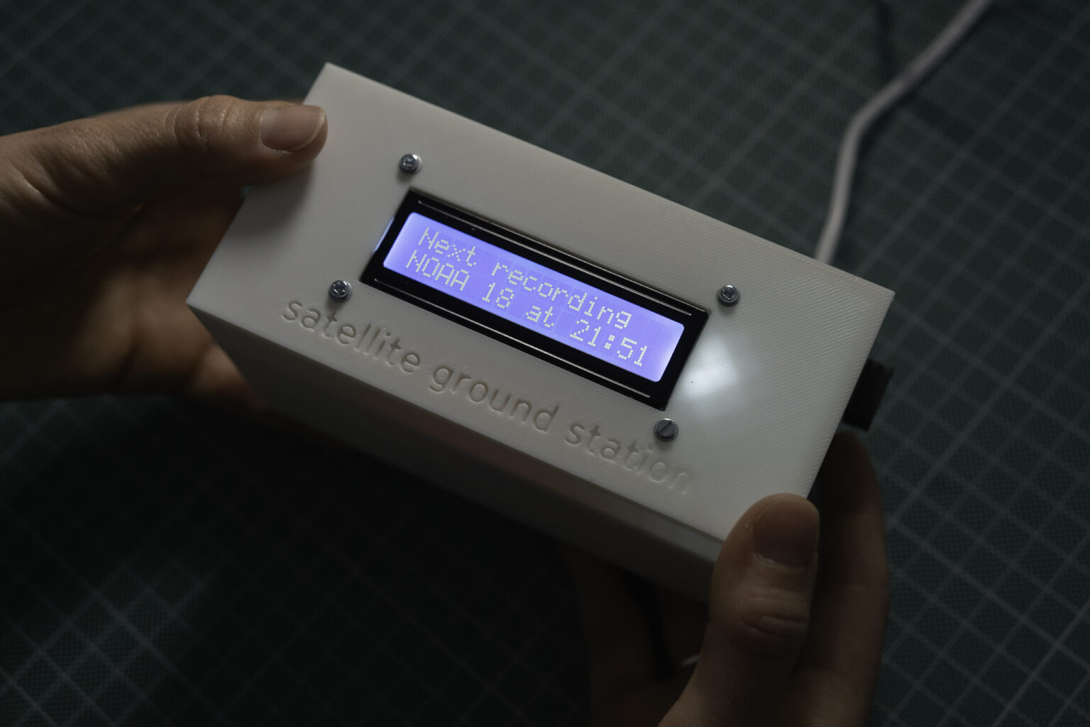
The open-weather Automatic Ground Station (AGS) is a radio receiver of Automatic Picture Transmissions (APT) from weather satellites NOAA-15, NOAA-18 and NOAA-19.
We developed the AGS because manual satellite image capture can be time intensive and so, while still foundational to open-weather, is not always practical or possible. Its design and build adds open source hardware to our public resources for DIY satellite reception and decoding.
The project is a collaboration with artist Grayson Earle. Its API was developed by Rectangle.

Open-weather’s AGS builds on existing open and closed source hardware and software for automating the reception of satellite imagery to create an easy to assemble and intuitive to operate ground station.
These values are hardcoded into the project through decisions, such as to calculate the satellite orbits on the device rather than use third party software, the use of a simple config file to edit variables, and the option to 3D print casing. Combined with a ‘more is less’ approach, these design decisions mean that open-weather’s AGS can be an entry point into learning about radio and satellites, weather and climate, microcontrollers and code.
What can an open-weather AGS do?
The open-weather AGS can:
- download Two-Line Element (TLE) data and calculate when the satellites NOAA-15, NOAA-18 and NOAA-19 will pass over the its location
- select the ‘best’ satellite pass to receive, e.g. pass with the greatest maximum elevation
- record the selected satellite pass at the correct frequency, bandwidth, and modulation
- save the sound file (.wav) to a USB stick and then send it over wifi to a server*
- display messages on an LCD screen that describe what it is doing and common errors
- fetch and install updates to its code daily
* By default this is the API for the open-weather Public Archive
An config file stored on the AGS’s externally accessible USB stick contains the following editable variables:
- unique ID
- latitude and longitude
- antenna gain
- buffer minutes
- wifi network name and password
- API key

Build your own
The AGS code and 3D file for printing the casing are open source. They can be accessed here via the project’s GitHub repository.
Open-weather is working with Grayson Earle to document the project and test the AGS in different locations, so that others can easily replicate our work. Over the coming months, we will publish project updates and further documentation.
Credits
AGS hardware design and code (and nontrivial debugging) by artist and activist Grayson Earle to whom we owe you a debt of gratitude. Thank you Grayson for you skill, generosity, and expert yet patient instruction over countless calls.
Public Archive API by Rectangle (Lizzie Malcolm and Dan Powers).
Bill Liles (NQ6Z) assisted with the debugging.
Special thanks to Rectangle and Bill Liles.