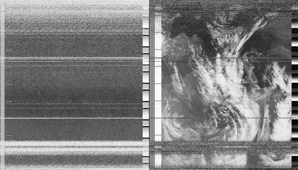
"And this is how it sees storms!" I write to Michaela, sharing a vividly coloured enhancement of the satellite image that we had received earlier, standing at the bus stop outside our shared studio space. "That’s just another name for us", she replies with the wit of the screenwriter she is. I like this thought – that we are storms. Robert, standing next to me, looking at my laptop screen, points out the Gaza Strip. I dismissed his observation because the the section of image beneath the map overlay appears to be only noise. Later, when I turned off the map overlay, to my surpsie Gaza's coastline was still visible – noisy but indisputably present in the image. How many times has Gaza been visible, only for me to not see it? I have spent the day working remotely with colleagues in London on digital platform for investigations into Gaza War. And now, somehow, without realising, from my local bus stop I have formed an indirect yet unbroken line-of-sight with the Palestinian territory.
Date
27 March 2024 21:42:54Location
Malzgasse bus stop, WienCountry or Territory
AustriaName
Soph DyerSatellite
NOAA-18Radio Callsign
Latitute / Longitude